The route of flight was from Beverly, to Bedford, over Norwood, Kingston, and then along the inner edge of the Cape, all the way to Provincetown Airport.
I flew low and slow for capturing some abundant breath-taking views of beaches along the inner coast of the Cape Cod Circle.
But the biggest memory of the trip was Zain's taking control of the plane for brief moments, during which he did some Zero G maneuvers with assistance from dad. He would pull back on the yoke so the plane entered an ascent, then he would push down to put the plane in controlled free fall. He did very well, but needed dad to assist him with limits.
Zain tried some steep turns as well. Dad had to brush up on his own skills with steep turns before Zain could try. Since we were on flight following, we were politely asked to resume on-course heading, after ATC noticed some odd behavior.
After putting the plane on auto-pilot, and letting Zain take care of the rest of flying, I decided to snap some pictures, and test Avare (The aviation GPS application that I designed and coded myself).
Avare worked quite well on Nexus-7, although I used an external Bluetooth GPS for better altitude awareness. A WAAS capable GPS gave me altitude accuracy of a few feet. I flew over a certain airport, set the Kollsman window to correct pressure setting at that airport, then compared the altimeter indication with Avare altitude indication. I found error of a few feet to up to 20 feet. In this instance Avare shows 2573 feet, while the altimeter in the plane is showing 2590 feet, an error of only 17 feet. The seam you see in the chart is caused by FAA paper chart seam.
Here are some pictures of the inner Cape Cod coast.
During the flight, I compared Avare with a Garmin aviation GPS. The indications of speed, bearing, distance, and time to destination were within rounding error.
Speed: 109 knots (Garmin), 108 knots (Avare)
Distance: 18.6 (Garmin), 19 (Avare)
Estimated time en route: 10 minute 16 seconds (Garmin), 10 minutes (Avare)
Heading to destination: 86L (Garmin), 86 (360 - 349 + 75) (Avare)
There is a lot of glare from Nexus-7 screen so it probably needs an anti-glare screen cover. Glare did not bother me much though.
There was one point near Sandy Neck area that got my attention. The colors of ocean and sand mixed with underwater sea-algae created dazzling effects.
I have never been to Sandy Neck, but its beach beauty is nearly on top of my list (at least from the air).
 |
| This is a light house at the end of Cape, after Provincetown |
 |
| I tried Avare on dash board, but that restricted my view of the open world. |
I tried Avare on an old first generation (Hero) Android device as well. Performance was similar to that on Nexus-7. I am memory bound, not CPU bound, hence the performance bottleneck is unzipping and loading images from the SD-CARD repeatedly in memory as I pan and zoom. The altitude differs between Nexus-7 and Hero, because Hero does not have WAAS capable GPS.
 |
| One more view of Sandy Neck |
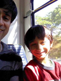
We landed at Provincetown Airport, took a bus to the town, ate our lunch there, had some exceptionally good ice cream, sat on the beach for a while, then took the bus back to the Airport. A very well spent day with Zain.
I relied solely on Avare for my navigation needs. I flew within a few hundred feet of class B airspace in BOS, but was never called by tower. At the end of the flight, I concluded that Avare is ready for prime time, and I can now sell my Garmin on Ebay for a $400 pay day.


Dude - you rock! Such a nice man!
ReplyDelete