Taking my family of four on a flying excursion has always posed some challenging situations. Wife is extremely afraid of flying in small planes, and kids are usually fussy at critical moments. I hope with more trips, they will get used to travel in the flying "rickshaw".
Just like our last trip to New York, the trip to Martha's Vineyard on Sunday was quite challenging. Other than usual discouragement pre-flight from my dad and wife, the weather was quite not fair. It was clear but quite turbulent. On small planes, even a moderate turbulence can send things flying in the cabin, and that is what we flew through. Kids loved the roller-coaster ride, but wife hated it.
 |
| Numerous Report for Turbulence and Wind Shear |
NOAA sometimes overstates turbulence intensity. The more reliable indicators of turbulence is the pilot reports. When we took off at 9AM, there was not a single pilot report of turbulence in the area but by noon, reports were coming in non-stop. The Cape and Boston approach controls was advising of turbulence all the way to ten-thousand feet. We encountered manageable jolts and swings, and I almost reported a pilot report myself. If I was flying by myself, it would have been a non-issue. I have encountered worse jolts over mountains in California. The kids were well behaved during the entire travel, but wife shrieked occasionally. Adding to her woes were the landing and take-off at Katama airport on grass runways.
 |
| Katama Airpark, Katama Farm, and South Beach |
The destination airport at Katama has three grass runways. There was no one in the pattern, and no one on the ground to answer my calls for the active runway and its pattern. Obviously I chose the runway most aligned with the wind. That required an approach from the beach side. Grass airports are pretty hard to locate. I mistook a farm as the airport, and started approach to it in the general direction of the runway. At about 500 feet, I saw some cows, then added power to climb back up to pattern altitude. Almost landed in the farm!
 |
| This is the Longest Runway, but I did not Land on it |
After I flew around the farm, I found the airport and its barely visible runways. I made the second approach from the beach side and managed to land on runway 35, over some beach mansions, when the wind at nearby MVY was reported at 15G20@330. Narrow and short grass runway gave the illusion of being too far, causing a steep turn to final at high speed. The roll out was bumpy and long. On the co-pilot seat, Momina hid her face behind her hands.
 |
| Waiting for the South Beach Route Bus |
 |
| Farm Institute and Classic Aviators, but no Flying Sheep in Sight |
Katama airport is next to South Beach on Martha's Vineyard. You can call it a land-and-walk-to-beach destination. But it was not a beach day as it was quite windy.
 |
| South Beach, MV |
 |
| And its Windy |
We took a bus to Edgartown, had some food at Atlantic Seaside, then rented a couple of bikes from the town center.
 |
| Father and Son on the Bike |
 |
| Mother and Daughter on Another Bike, Having Some Fun |
After we explored Southern and Eastern sides of Martha's Vineyard on bike, we took the bus back to the airport. I was hoping to get some aviation fuel at Katama, but the fuel pump was dry. I met a person at the airport who told me that the airport was not going to open formally till May 18. After a briefing with flight watch in which I was warned of widespread turbulence, I took off.
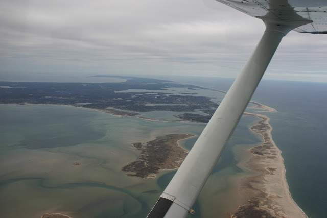
The wind had picked up and was gusting to 30 knots in the afternoon, but it was a simple take-off from a grassy runway most aligned with the wind. I landed on MVY airport for fuel, then headed back to Beverly. Kids fell asleep in a bumpy ride back home, and Momina got some courage and snapped a couple of pictures with her cell phone.
 |
| Buzzards Bay View of The Islands |
 |
The Tire Shot High at 5500 Feet
|
At Beverly, I requested the controller for a kid's visit to the control tower, which was promptly denied due to the absence of the secondary tower staff.
 |
| Need a Caption |


